Themes & Projects
Browse
All Items
Divisions
Subjects
My Collections
Themes & Projects
About
Advanced Search
Help us improve our site.
Please take our survey
!
Digital Collections User Survey
×
Loading…
Home
Filtered search
FILTER SEARCH
Exclude Born Digital Content
DATE RANGE
to
Limit
ONLINE FORMAT
Image
31
ORIGINAL FORMAT
maps
11
ORIGINAL FORMAT
×
ORIGINAL FORMAT
COUNT
maps
11
LOCATION
Fear, Cape (N.C.)
2
Kitty Hawk (N.C.)
1
North Carolina
1
LOCATION
×
LOCATION
COUNT
Fear, Cape (N.C.)
2
Kitty Hawk (N.C.)
1
North Carolina
1
THEME/PROJECT
North Carolina Maps
Military History
3
Military History: Marines
3
Natural Disasters
1
THEME/PROJECT
×
THEME/PROJECT
COUNT
North Carolina Maps
31
Military History
3
Military History: Marines
3
Natural Disasters
1
SUBJECT
Cape Fear River (N.C.)--Maps
2
Cape Fear River (N.C.)--Navigation
2
Fear, Cape (N.C.)--Maps
2
Nautical charts--North Carolina--Cape Fear River
2
Coasts--North Carolina
1
Dare County (N.C.)--Maps
1
Fryingpan Shoals (N.C.)--Maps
1
More
SUBJECT
×
SUBJECT
COUNT
Cape Fear River (N.C.)--Maps
2
Cape Fear River (N.C.)--Navigation
2
Fear, Cape (N.C.)--Maps
2
Nautical charts--North Carolina--Cape Fear River
2
Coasts--North Carolina
1
Dare County (N.C.)--Maps
1
Fryingpan Shoals (N.C.)--Maps
1
Fryingpan Shoals (N.C.)--Navigation
1
Kitty Hawk (N.C.)--Maps
1
Nautical charts--North Carolina--Fryingpan Shoals
1
North Carolina--Maps
1
U.S. Coast and Geodetic Survey
1
DIVISION
East Carolina Manuscript Collection
4
Joyner NC Maps
3
Joyner NC Maps Oversize
1
Joyner Rare
1
DIVISION
×
DIVISION
COUNT
East Carolina Manuscript Collection
4
Joyner NC Maps
3
Joyner NC Maps Oversize
1
Joyner Rare
1
Filters
Search Results
31 results found for:
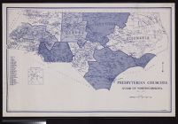
Methodist Protestant Church (U.S. "1830-1939)"
Theme/Project:
North Carolina Maps
Sort by:
Relevance
Date Digitized
Date Created
View all
North Carolina Maps
material.
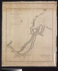
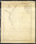
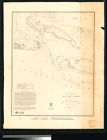
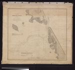
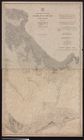
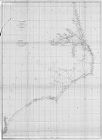
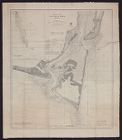
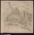
Presbyterian churches Synod of North Carolina ; W....
Mouths of Roanoke River, North Carolina triangulat...
Core Sound and straits, North Carolina U.S. Geolog...
Shaffer's map of Wake County, N.C.
Topography, state of North Carolina Chocowinity qu...
Sketch of Frying-Pan Shoals and Cape Fear River by...
Cape Lookout Shoals hydrography by the party under...
Eastern Craven County North Carolina Highway Map (...
Kitty Hawk Quadrangle, North Carolina, Dare Co., 7...
Preliminary sketch of Beaufort Harbor, North Carol...
Oregon Inlet, N. Carolina triangulation by W. M. B...
Portions of Murphy and Nantahalah sheets, North Ca...
Pamplico Sound, North Carolina. Eastern sheet.
Map of North Carolina coast
Map of Western North Carolina showing location of ...
Sketch of Frying-Pan Shoals
Preliminary chart of lower part of Cape Fear River...
Map of Wilmington Presbytery
Eastern Craven County and Carteret County, North C...
Map of Gaston County, N.C. showing rural delivery ...
Eastern Craven County North Carolina Highway Map (...
Sketch of Beaufort Harbor, North Carolina from a h...
Entrances to Cape Fear River
A Plan of the Town & Port of Edenton in Chowan Co...
Map of North Carolina showing location of water sa...
Map of North Carolina by W.C. Kerr ; assisted by W...
Map of North Carolina showing stream gaging statio...
Pasquotank River from a trigonometrical survey und...
Map of the county of Halifax, North Carolina, 1914...
Neuse River, North Carolina.
Beaufort Harbor, North Carolina.